Restrictions
It is best to walk this track between late November and the end of April. The upper Snowy Creek Bridge is removed in mid-May and returned in late Spring/early summer, due to significant avalanche risk.
Description
Dart Track closed due to slip
A large slip in Dart Valley between Daleys Flat Hut and Chinamans Bluff has made the Rees-Dart Track circuit impassable for trampers. Dart Track is closed until at least December 2026.
Options for trampers:
- Option 1: Walk from Muddy Creek to Dart Hut and back out the same way (just Rees Valley)
- Option 2: Walk over Cascade Saddle to Dart Hut and out along Rees Valley
- Option 3: Helicopter transfer with Heli Glenorchy over the affected section of track (Top of Dredge Flat to Surveyors Flat – one hour walk from Chinamans Bluff). Pre-book with Heli Glenorchy.
Option 1: Walk from Muddy Creek to Dart Hut and back out the same way (just Rees Valley)
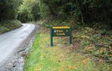
Muddy Creek to park boundary
Time: 4–5 hr
Distance: 12 km
Camping: No camping in this section – the park boundary is marked by a sign.
Take the vehicle track from Muddy Creek and follow the marker poles across the boggy section beyond Arthurs Creek.
A side trip to the Kea Basin begins on the other side of the Rees River north of the picturesque Lennox Falls. Continue up the grassy flats to the swing bridge on the national park boundary.
This track crosses private land. Respect the landowner’s property and leave all gates as you find them.
Park boundary to Shelter Rock Hut
Time: 2–3 hr
Distance: 7 km
Warning: Avalanche paths between the upper bushline and Shelter Rock Hut can make travel hazardous from late autumn to early summer.
There is a marked track through the bush and a swing bridge crossing to the west bank of Rees River. The track continues through beech forest past Clarke Slip to the bush edge.
Waterfall Creek bridge between Clarke Slip and Shelter Rock Hut has been structurally damaged and cannot be used. Extreme caution is required here during heavy rains and high creek flows - the creek can become dangerous and crossing it is not advised.
Above the bush, the track crosses several gullies that are avalanche paths. Take care crossing these gullies in spring and early summer when late snow may still pose a risk. Half an hour up from the bush edge, cross a bridge to the river’s east bank to reach the 22-bunk Shelter Rock Hut.
Category: Serviced
Facilities: 22 bunk beds, heating, mattresses, toilets - flush, water from tap - not treated, boil before use
Time: 4–6 hr
Distance: 10 km
Camping: Not allowed between Shelter Rock Hut and Dart Hut – this is to protect these fragile alpine and subalpine areas.
Warning: The upper Snowy Creek bridge is removed each winter and is returned when the snow clears, which can be as late as December. This creek can be hazardous so extreme care must be taken if crossing it. Avalanche paths between the bushline and Dart Hut can make travel hazardous from late autumn to early summer.
Heavy rain can cause the creeks in this section to flood and become impassable. Consider the weather before you leave Shelter Rock Hut and stay in the hut if needed.
The track between Shelter Rock Hut and Dart Hut is narrow with a number of steep drop-offs, particularly in the upper Snowy Creek. Follow the true left of Rees River as the track goes through scrub then rises about 100 m above the river.
The track sidles into the tussock-filled upper basin and follows the river’s bed. On the final steep climb to the 1471 m Rees Saddle, there is a lightly marked track close to the bluff on the left.
From the saddle, follow the orange markers as the track drops and passes tarns to a tussock bench well above Snowy Creek. Make sure you follow the marker poles, as people have been injured while going off-track in this area.
From here, the track traverses steep slopes that can be dangerous when wet or snow covered. There are some steep drops beside the track, so stay on the track, go slowly and watch your footing.
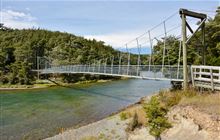
A bridge crosses upper Snowy Creek, and the track sidles across broken slopes before descending sharply. The Dart Hut is on Snowy Creek’s true left and can be reached via a swing bridge.
Option 2: Cascade Saddle to Dart Hut
Time: 4–5 hr
Distance: 10 km
The route to both the Dart and Rees valleys veers off to the left, just before you reach Cascade Saddle. Follow the orange poles along the ridge, then the rock cairns through the steep and unstable slopes down to the valley floor and lateral moraines of the Dart Glacier. The traverse from the ridge to the valley floor is above 1500 metres and very exposed to the weather.
Stay on the true left bank of the Dart River/Te Awa Whakatipu – the left side looking down river. You will need to ford several side streams. The water level rises quickly with either rain or afternoon snow melt, take care in particular with streams further down the valley, close
to Dart Hut.
Slightly upstream from the confluence of the Dart and Snowy Creek, a bridge over the creek leads to Dart Hut.
The track becomes slippery in wet conditions and a fall can be fatal – turn around if weather deteriorates.
Category: Serviced
Facilities: 32 bunk beds, heating, mattresses, toilets - flush, water from tap - not treated, boil before use
Option 3: Helecopter transfer
Helicopter transfer with Heli Glenorchy over the affected section of track (Top of Dredge Flat to Surveyors Flat – 1 hour walk from Chinamans Bluff). Pre-book with Heli Glenorchy.
Restricted access – Te Korokā (Dart/Slip Stream)
The land on the true right of the Dart River, from Sandy Bluff (opposite the Dart Track slip) through to the area between McBride Burn and the Beans Burn catchment, is Te Korokā (Dart/Slip Stream) Specially Protected Area.
Public access is not permitted. Entry to this area is by special permit only. This area is not an alternative access route up the Dart Valley. Hunting and unauthorised entry are prohibited.
Fees and bookings
You need to pay fees to stay at the huts on this track.
Bookings are not required - first come, first served.
Backcountry Hut Passes are valid for use in this hut from 1 May to 30 September. Passes won't be accepted from 1 October to 30 April.
Hut
1 May - 30 September
- Adult (18+ years): $25 per night
- Child/youth (5–17 years): $12.50 per night
- Infant (0–4 years): free
1 October - 30 April
Weekdays:
- Adult (18+ years): $28 per night
- Child/youth (5–17 years): $14 per night
- Infant (0–4 years): free
Weekends:
- Adult (18+ years): $32 per night
- Child/youth (5–17 years): $16 per night
- Infant (0–4 years): free
1 December - 29 February
Weekdays:
- Adult (18+ years): $29 per night
- Child/youth (5–17 years): $17.50 per night
- Infant (0–4 years): free
Weekends:
- Adult (18+ years): $34 per night
- Child/youth (5–17 years): $17 per night
- Infant (0–4 years): free
Camping
Before you go, buy Hut Tickets for each night's stay. Put this in the honesty box at the hut. Or buy a Backcountry Hut Pass or Campsite Pass.
About hut tickets and passes | About campsite passes | Retailers that sell hut tickets and passes
Campers may use hut water supply and toilets.
Getting there
The Rees track begins 68 km from Queenstown, via Glenorchy, and there is a car park at Muddy Creek.
It's possible to take 4WD vehicles beyond Muddy Creek, but as Muddy Creek is prone to sudden washouts which make it impassable. It's not advisable to leave vehicles for any length of time on the other side.
The Dart track begins 76 km from Queenstown via Glenorchy. A 2WD road extends to Chinamans Bluff, however, this is a fine weather road only and subject to washouts and flooded creeks.
Maps
NZTopo50 – Sheets CA10 and CB10
Transport operators
View DOC-approved businesses that provide transport and guided options in Mount Aspiring National Park.
Destination Queenstown also has information about transport providers.
Know before you go
Camping
Campers are encouraged to camp outside the huts. Camping on the Cascade Saddle Route is only permitted near Cascade Creek.
Be aware that kea chew tents and steal gear at Cascade Creek Campsite and on the Cascade Saddle Route. Do not disturb kea. They are a protected species and are in their natural habitat.
Campers are encountering mice in large numbers. Food should be stored in a rodent proof containers to not attract pests and prevent packs and tents from being chewed.
Water
Water at the huts is not treated. Boil before use or take enough water treatment supplies.
Be careful of river crossings on the Rees Dart track
Rivers and streams flood often on the Rees Dart Track, both after heavy rain and in spring/summer when snow is melting. They are very dangerous when in flood.
Flooding at Cattle Flat, in the lower Dart valley, on the Cascade Saddle Route and in upper Snowy Creek (when the bridge is removed) is particularly hazardous.
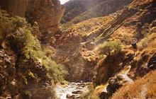
Snowy Creek
Image: Gareth Jones | DOC
Down stream of Dart Hut
Image: Gareth Jones | DOC
Assess all stream crossings carefully. If you aren’t confident they are safe to cross, then stay out and wait for water levels to drop.
Always carry an emergency shelter and spare food on the Rees Dart Track, as it is common to be delayed by flooded streams.
Lighting fires
Fires should only be lit in designated fireplaces and must be kept small. Do not use live vegetation on fires and have containers of water close by for controlling any fires that get out of control. Always make sure the fire is out before leaving the area. Gas cookers should be used for cooking – care is required with these.
Crossing private land
The section of track from the Muddy Creek car park to the national park boundary (12 km) crosses the Rees Valley Station. This is private farmland. Stay on the track and do not camp, hunt or disturb stock on this land.
Be prepared for all weather
The upper Rees valley and Snowy Creek area are exposed with no shelter in bad weather. Cold temperatures, snow, high winds, and heavy rain are possible at any time of the year. The weather and track conditions can change at any time. Check with the visitor centre for information on current conditions.
Talk to the Queenstown Visitor Centre, especially if walking in the shoulder seasons
Contact the Queenstown Visitor Centre before your trip, for advice on the current track conditions. If you are walking at either end of the usual walking season, talk to the Visitor Centre about snow conditions and avalanche risk.
If you are planning a trip in Spring or early summer, it is very important to contact the Visitor Centre to find out if the Snowy Creek bridge has been installed yet. Crossing the creek without this bridge is dangerous.
Takahē conservation in Rees Valley
18 takahē were released into the Rees Valley in February 2025.
You may see takahē as you walk, hunt or stay at the hut in Rees Valley. They may disperse into other areas. There are around 500 in the total takahē population as of 2024.
At a glance, people may mistake the takahē for a pūkeko. Takahē are a large bird with deep blue and green colouring, sturdy red legs and beak.
The chicks are black and small, as they grow, they will grey out. The juveniles will go from grey and muted blue and green, to the striking colours as they mature. Find information about takahē conservation: Takahē Recovery.
If you see a takahē
To keep takahē safe in their new home:
- keep a respectful distance to reduce stress on the birds
- don't share any food with takahē as human food can make them sick
- report any sightings (particularly outside the Rees Valley). Try to note details such as location, number of birds and leg band colours.
What to take
Personal equipment
- Backpack – 40–60 litre size for multi-day hiking
- Waterproof/plastic pack liner
- Sleeping bag – 3–4 season
- First aid kit including blister treatment materials - see Mountain Safety Council first aid advice
- Survival kit including survival blanket, whistle, paper, pencil, high energy snack food
- Safety equipment relevant to the track and time of year, for example, map, compass
- Torch/flashlight and spare batteries
- Rubbish bag
- Booking confirmation and ID
- Earplugs for communal bunkrooms
- An emergency shelter, for if you are trapped by flooded rivers or bad weather
- A distress beacon
Cooking and food equipment
- Drink bottle – 1–2 litre capacity
- Eating and cooking utensils – knife, fork, spoon, plate, cup, pot/pan/billy, cleaning kit, tea towel. Check individual huts for what cooking facilities and lighting are provided.
- Matches or lighter in waterproof container
Toiletries
- Toiletries, including insect repellent, sunscreen, and personal medication, for example, antihistamine for allergy to wasp stings
- Use a toilet when you see one and be prepared with a backup toilet option
- Some of our Great Walk huts have sanitary bins but do come prepared if there isn't one. Find out more about Menstruation in the backcountry.
If camping
- Tent
- Sleeping mat
- Ground sheet
- Gas cooker
Clothing
- For multi-day walking you'll need at least one set of clothes to walk in and another dry set to change into at night.
- Tramping/hiking boots or firm footwear – should be comfortable and well broken in
- Socks – wool or polypropylene
- Shorts – quick dry material
- Shirt – wool or polypropylene
- Under layers, top and bottom – wool or polypropylene
- Mid-layers – wool or polar fleece
- Raincoat – waterproof, windproof with hood
- Overtrousers – wind and waterproof
- Warm hat and gloves
- Sunhat and sunglasses
- Extra socks, underwear, shirt/lightweight jersey
- Warm clothing to sleep in - hut bunkrooms don't have heating and can be cold
Optional
- Gaiters
- Lightweight shoes for inside the huts
- Fire starters
Food
You cannot buy food on the track. Carry all the meals and snacks you will need, plus some spare, and a water bottle. We recommend food that is lightweight, fast cooking and high in energy value.
We do not provide emergency food in huts. You will need to carry emergency food supplies in case you are delayed by weather.
Store your food in a rodent-proof container or bag. This is especially important if you are camping
May to October
In winter the Rees-Dart tracks are impassable to all but experienced mountaineers due to heavy snow, especially in the Upper Rees and Snowy Creek area. If attempting the track in that time, you'll need additional equipment.
You need to be totally self-sufficient. In addition to what to pack for an overnight or multiday tramp, you also need:
- food for at least two extra days
- stove and gas for cooking
- lighter or matches
- alpine equipment: ice axe and crampons
- avalanche equipment: beacon, snow shovel, avalanche probe.
- personal locator beacon
- mountain radio or satellite messenger (optional)
Physical fitness and good equipment will make all the difference to your enjoyment of the trip.
May to October (winter season)
In winter the Rees-Dart tracks are impassable to all but experienced mountaineers, due to heavy snow, especially in the Upper Rees and Snowy Creek area.
Expect challenging track conditions
Snow is present in higher areas and sometimes on lower areas. Deep snow can hide track markers.
Rees Saddle in winter
Image: DOC
Avalanche on the Cascade Saddle route
Image: Eiji Kitai
Between Rees Saddle and Shelter Rock Hut
Image: Kerrin Burnnard
Avalanches are possible
There are multiple avalanche paths that are typically active from May to November. The greatest risk is in areas with avalanche terrain rated as 'challenging' or 'complex' on the Avalanche Terrain Exposure Scale. These areas are:
- The Dart Track from the Whitbourn River confluence to the Dart Hut
- The final 1.5 km before Shelter Rock Hut on the Rees Track
- Rees Track between Shelter Rock Hut and Dart Hut
Avalanches can occur outside of these areas but are less frequent.
Read more about avalanche terrain and paths on the Rees-Dart Track and be avalanche alert in Whakatipu.
The upper Snowy Creek bridge is removed during winter due to the area being avalanche prone. The exact timing of this removal depends on weather and avalanche conditions.
Conditions are cold, wet and windy
During winter months, the Rees Dart Track is frequently cold, wet and windy. Dress for the conditions.
Expect reduced hut facilities
Hut facilities are reduced.
- Gas cookers are not provided – you need to bring your own cooking stove.
- Running water may not be available. Water can be obtained from the outside water tank; if this is frozen, then from the nearest watercourse or by melting snow. We recommend that you treat all stream water in case of giardia or other bugs.
- No DOC rangers.
- Pit toilets.
- No re-supply of fire place fuel - wood should be sourced from the forest floor for the next hut users.
- No emergency radio facilities.
You need to be totally self-sufficient
You need to be totally self-sufficient. In addition to what to pack on an multi day hike, you also need:
- food for at least two extra days
- stove and gas for cooking
- lighter or matches
- alpine equipment: ice axe and crampons
- avalanche equipment: beacon, snow shovel, avalanche probe.
- personal locator beacon
- mountain radio or satellite messenger (optional)
History and natural history
History
Early history
The Rees and Dart River valleys were well known to the Ngāi Tahu people of Southland and the Otago Coast. Ngāi Tahu and their ancestors used ara tawhito (traditional trails) for mahinga kai (food gathering) and pounamu trading. These ara tawhito crossed the main divide of the Southern Alps/Kā Tiritiri o te Moana.
The Dart River/Te Awa Whakatipu was part of the ara tawhito connecting Whakatipu-wai-Māori (Lake Whakatipu) with Whakatipu Waitai (Martins Bay). This was where one of the largest Ngāi Tahu kāinga (settlements) in South Westland was situated.
Ngāi Tahu travelled great distances to collect the valued, pearly grey-green inaka/koko-takiwai variety of pounamu. Many pounamu artefacts and the remains of several kāinga nohoanga (seasonal settlements) have been found at the head of Whakatipu-wai-Māori.
Today, ownership of all pounamu remaining within the takiwā (tribal boundary) of Ngāi Tahu and the adjacent seas are vested in Te Rūnanga o Ngāi Tahu.
From the 1860s
The first Europeans to explore the Rees-Dart area were surveyors, prospectors and run holders looking for grazing land. Surveyor James McKerrow finished his reconnaissance in 1863. By this time, many gold prospectors and miners were based at the head of Whakatipu-wai-Māori.
Sheep runs were established in the Rees and Dart valleys and at Mount Earnslaw during the 1860s.
In 1864, a mining party led by Patrick Caples crossed the Rees Saddle into the Dart River/Te Awa Whakatipu to search for reported gold. Little was found and after days of snow they retreated to the Rees valley. Caples was the first European to refer to the Dart Glacier, which he saw on this trip.
A gold dredge operated on the Dart River/Te Awa Whakatipu from 1899 until 1902. There is still evidence today of the gold sluicing that happened around the Whitbourn/Dart confluence circa 1870s.
Modern times
The areas remarkable natural landscapes and diversity were recognised in 1964 with the creation of Mount Aspiring National Park and again in 1991 with the establishment of Te Wāhipounamu – South West New Zealand World Heritage area.
More recently the valleys have been used as film locations for The Lord of the Rings, The Hobbit and Mission Impossible.
Tōpuni sites
In the mountains at the head of Whakatipu-wai-Māori lie Mount Earnslaw/Pikirakatahi and Te Koroka (Dart/Slip Stream). Both are important to Ngāi Tahu for their cultural, spiritual, historic, and traditional associations.
As part of the Deed of Settlement between the Crown and Ngāi Tahu, these two areas have been given the status of Tōpuni.
The concept of Tōpuni comes from the Ngāi Tahu custom of persons of rangatira (chiefly) status, extending their mana (power and authority) and protection over areas or people by placing their cloak over them or it. Tōpuni provides a very public symbol of Ngāi Tahu customary mana and rangatiratanga (chieftainship) over some of the most prominent landscape features and conservation areas in Te Waipounamu.
Tōpuni does not override or alter the existing status of the land but ensures Ngāi Tahu values are recognised, acknowledged, and provided for.
Access to Te Koroka (Dart/Slip Stream) requires a special permit.
Ngāi Tahu and Pikirakatahi
Sitting between the Rees and Dart rivers is Mount Earnslaw/Pikirakatahi. The creation of Pikirakatahi relates in time to Te Waka o Aoraki, and the efforts of Tū Te Rakiwhānoa.
It is said that during the formation of Pikirakatahi, a wedge of pounamu was inserted into this mountain. This is the highest and most prominent peak in this range.
The mountain is also linked to the travels of Rākaihautū. He dug out the great lakes of the interior with his kō (a tool like a spade), known as Tū Whakaroria and later renamed Tuhiraki at the end of the expedition.
Pikirakatahi was of crucial significance to the many generations that journeyed to that end of Whakatipu-wai-māori and beyond. Pikirakatahi stands as kaitiaki (guardian) over the pounamu resource and marks the end of a trail.
The tupuna (ancestors) had considerable knowledge of whakapapa, traditional trails, places for gathering kai (food) and other taonga. Also, ways in which to use the resources of the land, the relationship of people with the land and their dependence on it. And tikanga for the proper and sustainable utilisation of resources. All these values remain important to Ngāi Tahu today.
Natural history
The Rees and Dart valleys are surrounded by towering mountains made of green and grey schist and have been shaped by glaciation.
The Dart Glacier is now a small valley glacier. At its peak it was part of an enormous system that ended at Kingston, 135 km away at the southern end of Whakatipu-wai-māori (Lake Whakatipu). Huge moraine walls beyond Dart Hut show the previous extent of the glacier and how much it has receded in the past few hundred years.
Native plants
The forest is full of southern beech species, with tawhairaunui/red beech growing along the warm valley floor of the Dart River/Te Awa Whakatipu. Tawhairauriki/mountain beech and tawhai/silver beech dominate the rest of the Rees and Dart valleys.
Cold air from the Dart Glacier has lowered the treeline in the Dart valley to 900 m (200 m lower than elsewhere in the region). Above the tree-line, tussock grasslands dominate with flowering spikes of speargrass or Spaniard dotted between. Flowering herbs like mountain buttercups and daisies are common into the spring and summer.
Native animals
The Dart valley is notable for its populations of the endangered mohua/yellowhead, kākā and pekapeka/longtailed bat. Other forest birds such as kākāriki/New Zealand parakeet, kakaruai/South Island robin, miromiro/tomtit, pīwakawaka/fantail and pīpipi/brown creeper thrive in both valleys.
The cheeky alpine kea is also a significant valley inhabitant, along with the pūtakitaki/paradise shelduck, which is found on the river flats. Mātuhituhi/rock wren can be heard, if not seen, on the Rees Saddle and kōwhiowhio/whio/blue duck may be seen in the turbulent upper reaches of the rivers.
There are many invertebrates. Especially the abundant sandfly in the beech forest and grassy flats, and energetic grasshoppers in the alpine areas. Alpine wētā are found at the Rees Saddle and in the upper Dart valley.
- Dogs
- No dogs. Other pets on conservation land rules.
DOC's own page for this one